Arctic Grip and Deep Snow: Columbus Braces for Dangerous Cold After Weekend Storm
Level 3 Emergency and Ongoing Hazards
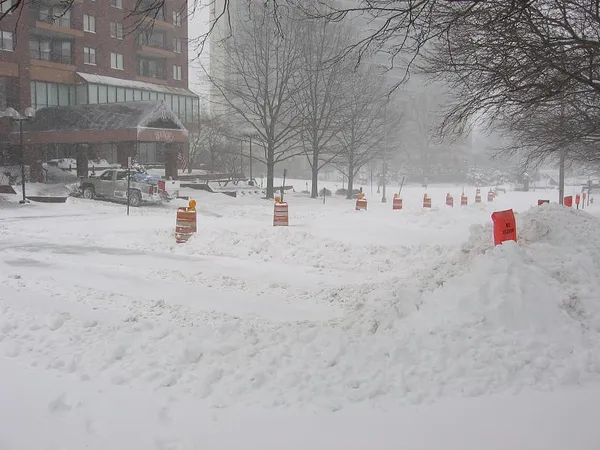
Columbus remains under a state of high alert today, Monday, January 26, 2026, as the city struggles to dig out from a massive weekend winter storm. Following snowfall totals that reached 11 inches or more in several parts of Franklin County, local officials have maintained a Level 3 Snow Emergency. Under this status, all roadways are closed to non-emergency personnel, and travel is strictly prohibited for those who are not essential workers. The National Weather Service has issued a series of overlapping alerts, including a Winter Storm Warning in effect until noon and a Cold Weather Advisory lasting until 6:00 PM.
The Frigid Temperature Breakdown
The most pressing concern for residents today is the arrival of life-threatening temperatures. While the daytime high is expected to reach only 15°F, the real danger lies in the wind chill. Gusty west winds reaching up to 21 mph will produce wind chill values as low as -7°F throughout the afternoon. As the sun sets, the situation will become even more precarious. An Extreme Cold Warning is scheduled to go into effect at 6:00 PM, as the actual air temperature is forecasted to plummet to a low of -6°F overnight. Wind chill values after dark are expected to hit a bone-chilling -21°F.
Morning, Afternoon, and Evening Forecast
- Morning: The morning hours will be dominated by patchy blowing snow and a lingering chance of light snow showers. Visibility remains low on local roads due to the high winds. Residents should expect the Winter Storm Warning to transition into a Cold Weather Advisory by midday.
- Afternoon: Between 9:00 AM and 5:00 PM, intermittent snow showers and flurries are predicted. The sky will remain mostly cloudy, with the temperature peaking at its daily high of 15°F. Patchy blowing snow will continue to drift across cleared surfaces.
- Evening and Overnight: Flurries are likely to persist until approximately 7:00 PM. After this time, the clouds will begin to break, but the drop in temperature will be rapid. The Extreme Cold Warning will be the primary concern as the city enters a period of dangerously cold conditions that will last through Tuesday morning.
Impacts and Safety Notices
The severity of the weather has led to widespread closures across the region. The Ohio State University has canceled all in-person classes for today and Tuesday, shifting to virtual instruction where possible. Residents are urged to stay indoors and avoid all travel. If you must go outside, ensure that all skin is covered to prevent frostbite, which can occur in as little as 30 minutes in these conditions. Ensure that pets are brought inside and that home heating systems are functioning safely during this extreme cold snap.