Foggy Start and Spring-Like Afternoon for Columbus
Commuter Alert: Heavy Fog Blankets Central Ohio
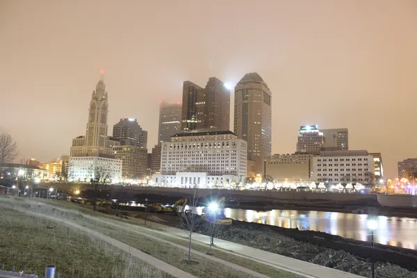
Columbus residents waking up this Tuesday, February 17, 2026, will find themselves navigating a thick gray shroud as a Dense Fog Advisory remains in effect for Franklin County and the surrounding areas. The National Weather Service has issued this advisory until 10:00 AM EST, warning that visibility may drop to a quarter-mile or less in many parts of the city. Drivers on major arteries like I-71, I-270, and SR-315 are urged to slow down, use low-beam headlights, and leave plenty of following distance during the early morning commute.
The morning starts on a chilly note with temperatures hovering around 34 to 36 degrees Fahrenheit. While the air is damp and the sky remains overcast, the fog is expected to gradually lift by late morning, giving way to a much milder atmosphere than is typical for mid-February in Ohio.
Unseasonable Warmth Arrives in the Afternoon
Once the morning mist clears, Columbus is set to experience a significant temperature surge. Forecasters are predicting a daily high of approximately 57 degrees Fahrenheit, a notable departure from the usual winter chill. This warming trend is driven by steady winds coming from the south-southeast at 5 to 10 miles per hour, pulling milder air into the region. Although the sun may struggle to peek through the persistent cloud cover, the afternoon will feel remarkably spring-like.
- Morning Temperature: 34°F - 36°F with heavy fog
- Afternoon High: 57°F with overcast skies
- Wind Conditions: SSE at 5-10 mph
- Precipitation: Less than 10% chance during daylight hours
Evening Outlook and Incoming Rain
As the sun sets over the Scioto River, temperatures will remain relatively mild compared to recent weeks. The mercury is expected to drop to an evening low of around 48 degrees Fahrenheit, which is nearly 20 degrees warmer than the average low for this time of year. While the daytime remains dry, the humidity will climb steadily as the evening progresses.
Clouds will thicken further as night falls, serving as a precursor to more active weather expected later in the week. While no immediate rain or wind warnings are in place for the evening hours, there is an increasing chance of sprinkles or light showers arriving after midnight and into the early hours of Wednesday. For those heading out tonight, a light jacket should suffice, but keep an eye on the sky as the atmosphere prepares for a wetter transition tomorrow.