Winter's Grayscale: Overcast Skies and Chilly Flurries Grip Columbus This Monday
A Cold Start to the Work Week
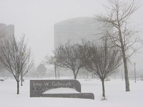
Columbus residents should brace for a brisk and gray Monday as we move through February 23, 2026. The transition from the weekend brings a return to classic Ohio winter conditions, characterized by high cloud cover and biting temperatures that will keep most people reaching for their heaviest coats throughout the day. While the region is not currently under any severe weather warnings, the combination of sub-freezing air and high humidity will make for a raw, uncomfortable environment for those spending time outdoors.
Morning: Frosty and Flurry-Filled
The morning commute is expected to be a chilly one. Temperatures at daybreak will hover around 23°F, though the wind chill factor will make it feel significantly colder—forecasted to feel closer to 16°F. Meteorological data indicates a 20% to 25% chance of light snow showers or flurries during the early hours. While major accumulation is not expected, a light dusting could create slick spots on untreated side streets, bridges, and overpasses. Visibility may be intermittently reduced during these brief bursts of snow, so local motorists are advised to exercise caution and allow for a few extra minutes in their travel schedules.
Afternoon: Persistent Overcast
As we head into the afternoon, the chance of precipitation will begin to taper off, leaving the city under a thick, stubborn blanket of overcast skies. The mercury is forecast to reach a daily high of approximately 30°F to 31°F, which is slightly below the seasonal average for late February. Despite the lack of high-velocity wind warnings today, the air remains damp with humidity levels expected to fluctuate between 65% and 83%. This high moisture content will likely intensify the perception of the cold, and with the sun remaining largely hidden, there will be little natural warmth to offset the freezing temperatures.
Evening and Overnight: Stepping Into the Deep Freeze
The clouds will persist into the evening hours, acting as a ceiling that prevents a total freefall of temperatures, yet the night will still be undeniably cold. Residents planning to be out tonight should prepare for the following:
- Evening temperatures will slide back into the mid-20s by 8:00 PM.
- Overnight lows are projected to hit 20°F, with some open suburban areas in Franklin County potentially seeing dips into the high teens.
- Wind speeds will remain light but consistent from the north, maintaining a steady chill throughout the overnight period.
Preparation and Safety Tips
Given the sustained low temperatures and the potential for overnight freezing, columbus.news recommends taking basic winter precautions today:
- Dress in multiple layers, ensuring your outer layer is wind-resistant to trap body heat effectively.
- Check on vulnerable neighbors and ensure pets are brought indoors as temperatures drop after sunset.
- Ensure your vehicle is equipped with a sturdy ice scraper and that your windshield wiper fluid is rated for sub-zero temperatures.
Looking ahead, the overcast pattern is expected to continue through Tuesday, with a potential for a slight warming trend later in the week. Until then, keep the winter gear close at hand as Columbus navigates this typical late-winter stretch.